


du canal du Loing aux berges du Lunain

raymond45
User

Length
17.7 km

Max alt
95 m

Uphill gradient
178 m
Km-Effort
20 km

Min alt
50 m

Downhill gradient
178 m
Boucle
Yes
Creation date :
2025-05-23 15:08:43.703
Updated on :
2025-05-23 15:09:40.136
4h34
Difficulty : Medium

FREE GPS app for hiking
 SityTrail
IGN / Geographical institutes
SityTrail Plus
The world is yours!
About
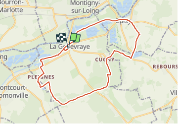
Trail On foot of 17.7 km to be discovered at Ile-de-France, Seine-et-Marne, La Genevraye. This trail is proposed by raymond45.
Positioning
Country:
France
Region :
Ile-de-France
Department/Province :
Seine-et-Marne
Municipality :
La Genevraye
Location:
Unknown
Start:(Dec)
Start:(UTM)
481185 ; 5352000 (31U) N.
Comments